
What to expect driving the Alaska Highway and the Cassiar Highway
Naturally North Idaho is a participant in the Amazon Services LLC Associates Program, an affiliate advertising program designed to provide a means for sites to earn advertising fees by advertising and linking to amazon.com. This post may contain affiliate links, which means I may receive a commission, at no cost to you, if you make a purchase through a link. Please see my full disclosure for further information.
North to Alaska!
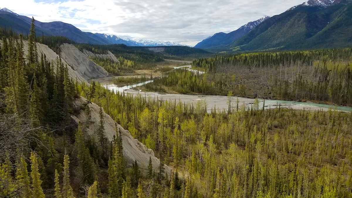
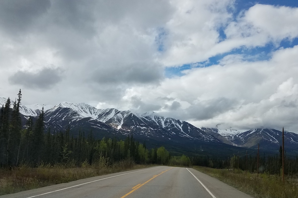
Driving to Alaska is filled with wildlife, beautiful vistas, adventure and excitement. Each time is different.
My husband and I decided to drive to Alaska with our kids this spring to show them how incredible Alaska and northern Canada are and because we missed Alaska. We used to work in Alaska seasonally for many years and would drive up from Idaho in the spring and back in the fall.
We’ve driven on both the Alaska Highway and the Cassiar Highway, which are the main routes to reach Alaska (here is a post on one road trip to Alaska). One of these days we’ll drive the Top of the World Highway through Dawson City instead of entering Alaska on the Alaska Highway by Beaver Creek, Yukon.
The Alaska Highway is also called the Alcan (Alaska-Canadian Highway). The Cassiar Highway is also called the Stewart-Cassiar Highway. The Cassiar Highway intersects the Alaska Highway about 13 miles west of Watson Lake, Yukon.
Depending on your starting location, you can drive one highway up and the other highway down, which is what we did in May. The Alaska Highway was closed at Fort Nelson because of forest fires, so our family drove up the Cassiar Highway first and came back via the Alaska Highway. Both are beautiful and have sections I love.
If you’ve never driven to Alaska, driving the Alaska Highway or Cassiar Highway will be an adventure. I’ve compiled seven pieces of advice when driving to Alaska plus four bonus items that would help provide peace of mind during the trip.
What to expect driving to Alaska
1) Gas Stations
When there is a road sign telling you the next gas station is 98 miles away, check your gas gauge. Towns are typically closer in the Lower 48, so gas stations are usually spaced closer together. In northern British Columbia and the Yukon, towns can be far apart. There are small outposts with gas stations along the way but they might not be open depending on the time of year.
A good rule-of-thumb is to fill up if gas is available. Another option is to carry a copy of the Milepost (more on that below) and plan out your gas stops. Bigger towns tend to have cheaper fuel but sometimes the options are extremely limited (like between Haines Junction and Tok).
Gas is more expensive. The highest we paid in May of 2024 was $2.14 per liter in Beaver Creek, Yukon, which equates to $8.10 per gallon (in Canadian dollars). Most credit cards will give you the exchange rate on your monthly statement.
For metric conversion, one gallon is 3.7854 liters. So multiply the pump price by $4 and you’ll have a slight overestimate of the price.
2) Wildlife
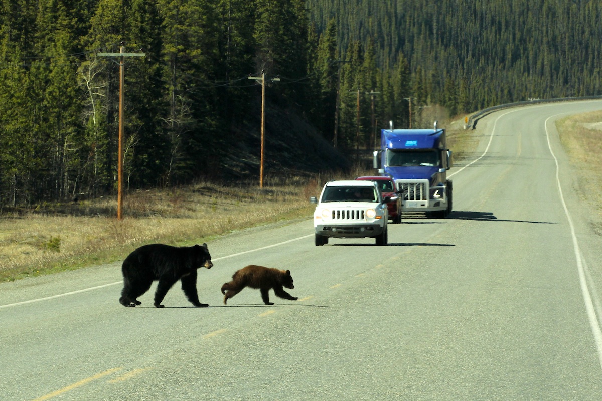
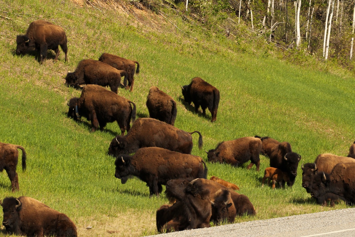
Depending on the time of year, the wildlife could be plentiful. On our trip this spring we saw 73 bears, 85 bison, 38 mountain goats, Dall sheep, Stone sheep, Bighorn sheep, moose, elk, porcupines and more! If you see a vehicle stopped alongside the road, they could be watching wildlife.
Please remember to stop only if conditions are safe. Please don’t stop on a curve, over the crest of a hill, if there isn’t any shoulder, or if someone is following close behind you. There were several animals we saw that we couldn’t stop for because of those conditions.
We saw Stone sheep in Stone Mountain Provincial Park and the oncoming traffic was stopped just over the crest of a hill. As we slowed down a semi-truck came over the hill and my husband said we had to get out of the way in case the semi-truck driver had to swerve to avoid the stopped vehicle. Luckily that vehicle moved and we found a pull-out just uphill that we could still see the sheep.

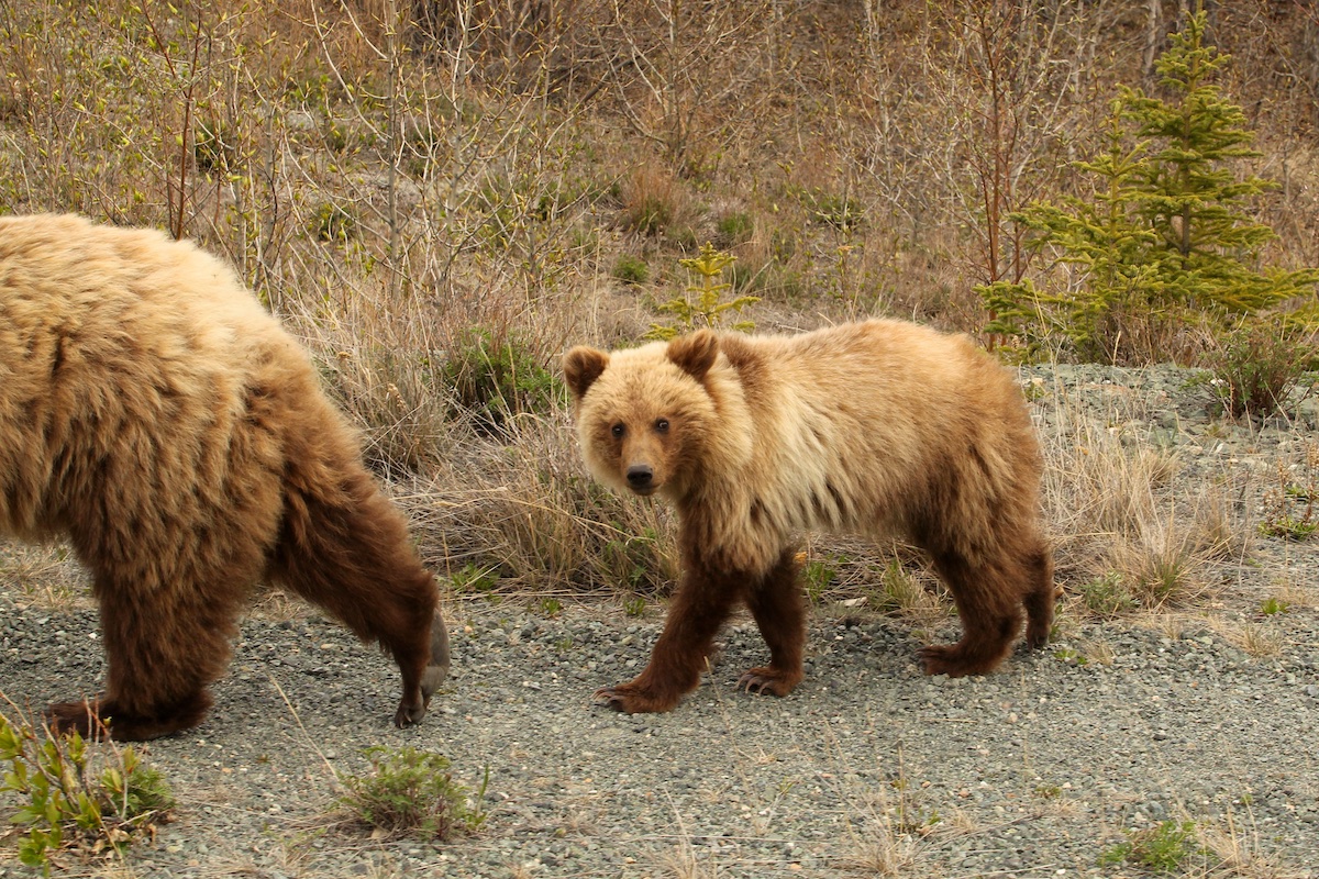
Since we traveled in spring, the bears were abundant (to the point that we didn’t stop for every one). A few bears were lying down in the dandelion patches in the right-of-ways munching away on dandelions. They just looked at us and continued eating. Other bears would run off into the woods.
Always give wildlife room. Don’t approach wildlife and preferably stay in your vehicle (especially for bears, bison, and moose).
We pulled up alongside a mama grizzly and two cubs—the closest I would ever want to be to a bear. We didn’t stay long because we didn’t want to make them mad. The whole time my husband was ready to drive away if they turned towards us and I was ready to roll up the windows. Awesome experience though. The kids were able to see a grizzly bear up close and see the actual size.
3) Road conditions
Washboards won’t seem so bad after frost heaves for hundreds of miles. The worst road is between Destruction Bay, Yukon and Northway, AK. In some places you can’t speed up before the next frost heave. Expect to travel at a slower pace between Destruction Bay and Northway (just before Tok, AK).
Frost heaves form because of ice freezing in the ground underneath the road surface. Of course, it doesn’t freeze evenly, so bumps and dips abound.
Road workers try to mark frost heaves but they can’t mark all of them or it would look like a parade line-up in that section. Farther south on the Cassiar and Alaska Highway, road workers also try to mark the frost heaves with signs or flags.
Another aspect of the roads is that they may be gravel, chip-sealed, or paved. Some have center and shoulder lines, others don’t. You may also notice a lack of guard rails in places you’d think there should be some (like along Muncho Lake). The whole gamut of road conditions awaits. And as with anywhere, there probably will be road construction.
For the majority of the trip, the roads are in good condition for both the Alaska Highway and the Cassiar Highway. Some stretches are newly done with smooth, wide shoulders and wide, clear right-of-ways.
4) Places to stop
Turnouts, pullouts, rest areas—plentiful in some areas and scarce in others. They seem to be scarce when someone needs to use the bathroom!
On the Cassiar Highway and in more mountainous terrain, there seemed to be more pullouts. The stretch between Pink Mountain and Fort St. John had very few pullouts. (I know because one kid really had to go to the bathroom right after a turnout and it seemed like forever until the next one. There wasn’t enough of a shoulder to pull off onto. We were passing through between 5 and 6 p.m. so all the oil and gas field workers were pouring out of the side roads, so we couldn’t safely pull into one of them.)
Rest areas with outhouses seem to be well-spaced. Other turnouts have litter bins, information signs or a good view. Some are just pull-outs to pull into to let other vehicles pass.
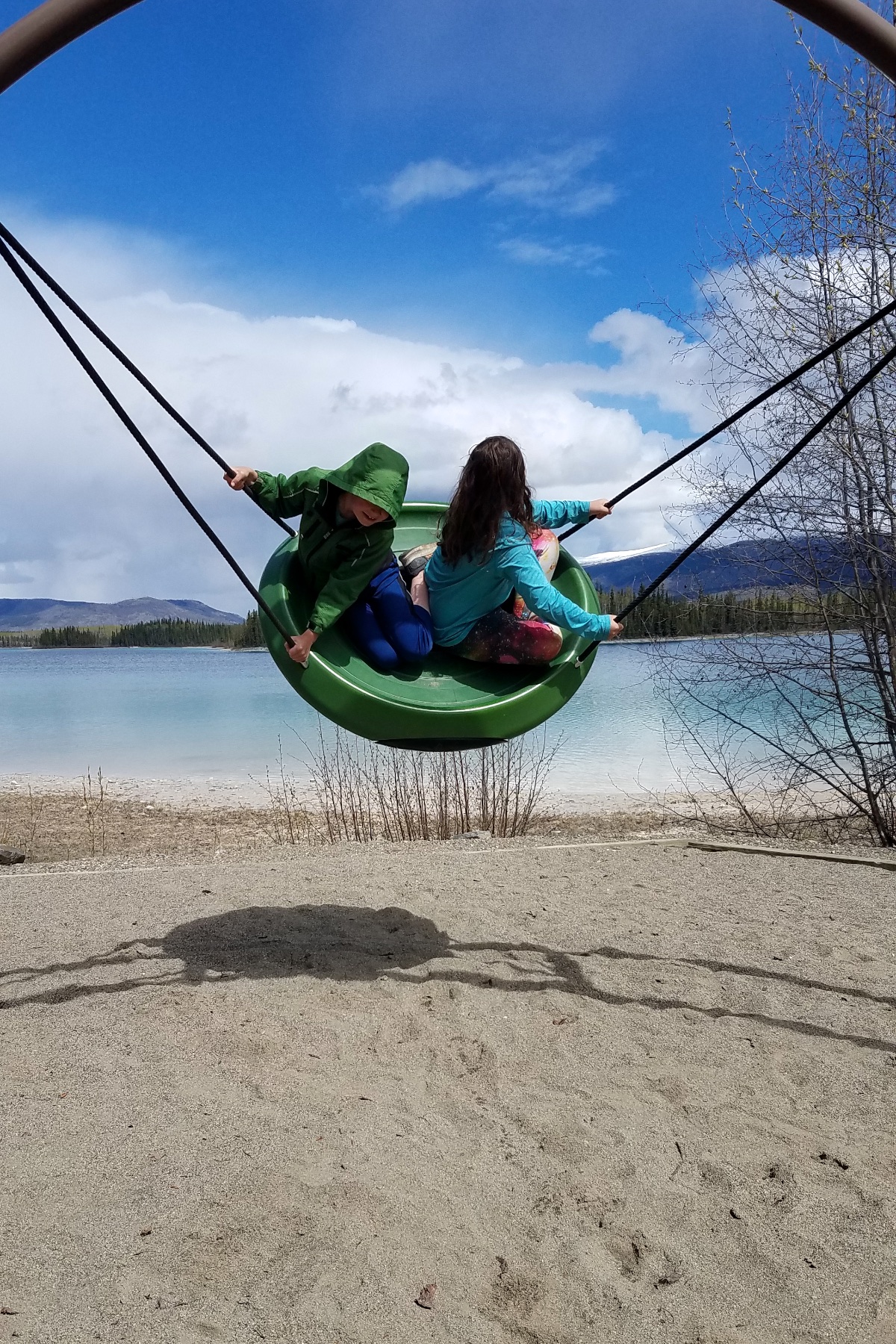
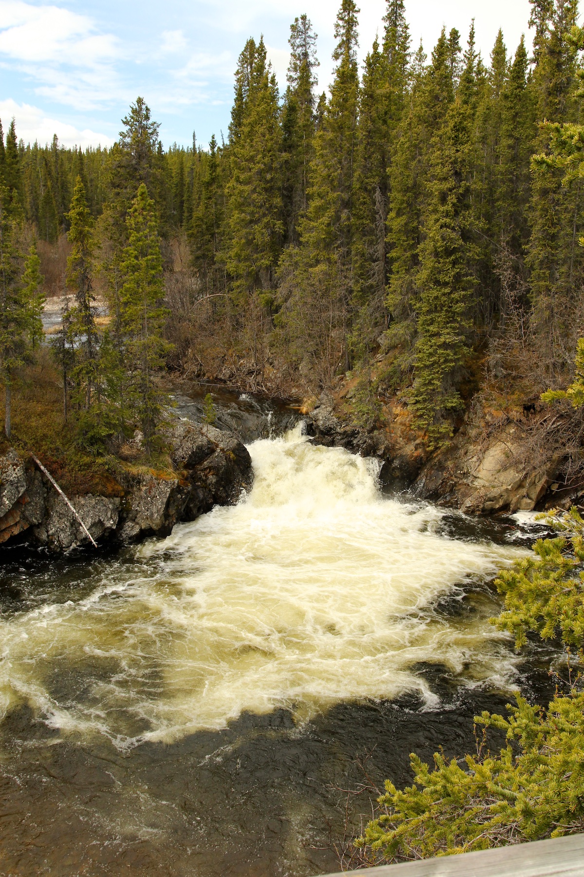
Provincial parks are wonderful. In British Columbia and the Yukon, provincial parks are free to enter and you only pay for camping. We stopped at several provincial parks to hike, check out waterfalls, enjoy the playgrounds or for a nice lunch spot.
5) Weather
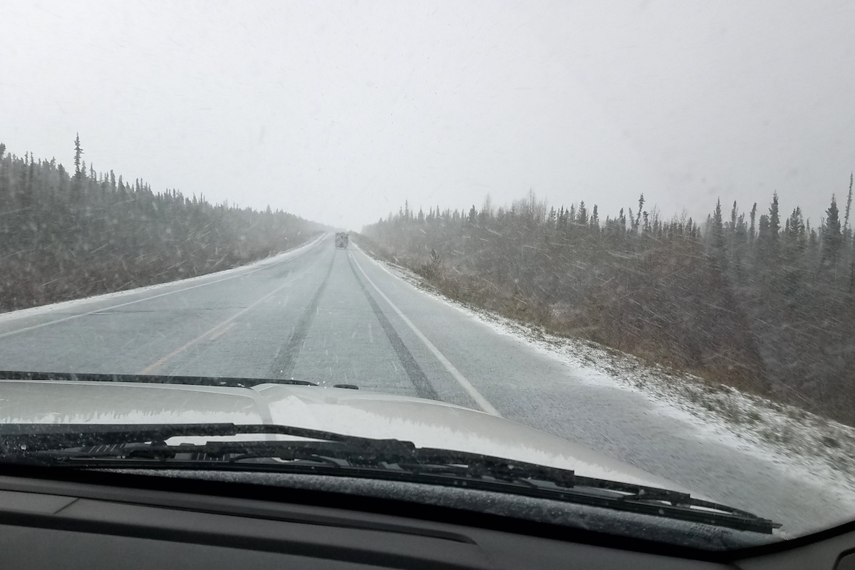
Rain, snow, hail, wind, fog, sun—they all happened in May on our trip. In April and October, we’ve encountered ice, slush, and ground fog so thick I was creeping along following the white line on the edge of the road.
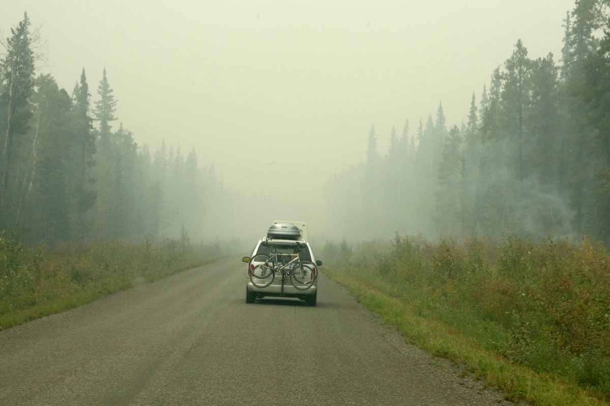
Also take into consideration smoke from wildfires. Smoke can impact visibility. Wildfires can close roads or slow down traffic by being led by pilot cars. As I mentioned earlier, the Alaska Highway was closed at Fort Nelson for a forest fire in May! Check road conditions online or at visitor centers because a detour means the other highway.
When we drove the Cassiar Highway in 2010, a forest fire was raging next to the highway. The road was closed for several hours and eventually a pilot car was able to lead traffic through one way at a time. There are signs at the Beaver Dam rest area about that fire. We were really hoping they would open the highway because otherwise it meant a two-day detour down the Cassiar, east on the Yellowhead Highway and north on the Alaska Highway.
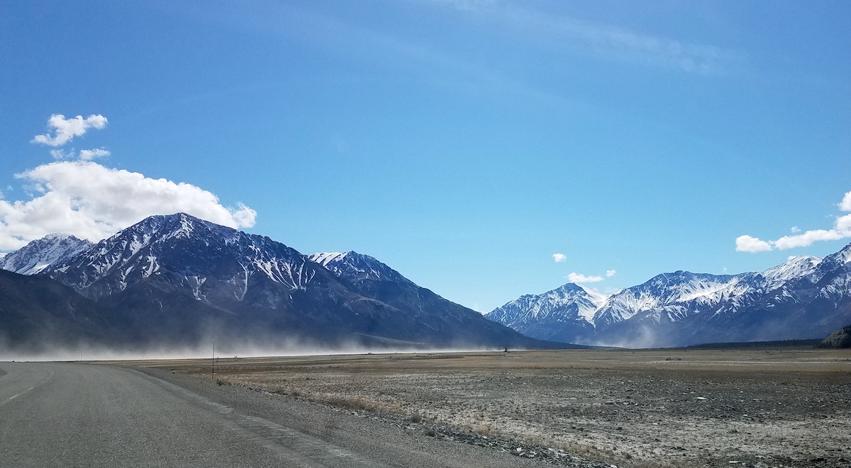
Driving the vast distance to Alaska through varied terrain provides ample opportunities for weather fluctuations.
6) ThinK Metric
Kilometers, not miles for distance. Being from the United States, I’m accustomed to English measurements so it took a little adjustment. I just remembered that about 0.6 mile equals 1 km. So approximately 60 miles equals 100 km. That provided a rough estimate when reading the mileage signs.
As I mentioned earlier, gas pumps are in liters until you reach Alaska.
Speed limit signs are in kilometers per hour. So 100 kmh is 60 mph. Some vehicles allow you to switch to metric mode on the dashboard, which really helped on this trip. All our previous vehicles didn’t have that option.
7) Vastness and Remoteness
The Alaska Highway is 1,390 Miles long from Dawson Creek, British Columbia to Delta Junction, Alaska. The Cassiar is 450 Miles long. In the Yukon and along the Cassiar Highway, one thing I noticed was there were very few side roads—very few.
The distance between towns is huge too—between Burwash Landing and Beaver Creek, Yukon is 105 miles (and they are really small settlements). Major towns are even farther apart—Fort Nelson to Watson Lake is 330 miles. We loved driving for hours and seeing very little human impact—huge swaths of forest, enormous lakes, and long valleys.
Cell service is patchy in northern British Columbia, the Yukon and parts of Alaska. Typically, service was available in towns IF your cell phone company covers Canada. Mine did not and my husband was able to purchase an international “pass” for a week at a time.
Bonus items to bring while driving to Alaska
Traveling the Alaska Highway and Cassiar Highway is quite an adventure that is very memorable. A few things can help ease your mind while traveling through the remoteness of Canada and Alaska. We carried all four of the following items while driving to Alaska.
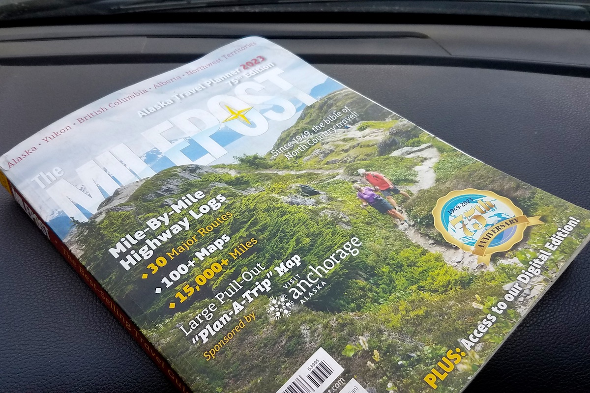
1) The Milepost
The Milepost may not be necessary but I found it invaluable. The Milepost is a thick book that tells you what to expect mile by mile on the Alaska Highway, Cassiar Highway, all the highways in Alaska and the main routes to the Cassiar and Alaska Highways from the US. This includes turnouts, rest areas, towns, gas stations, provincial parks, points of interest, playgrounds and more.
I planned our gas stops and found places to stretch our legs (or get the wiggles out). I also used the Milepost to plan where we were camping each night. Before the trip, I estimated where we would end up each night and had a few options highlighted in the book. Each mid-afternoon, I would project how far we would go the rest of the day and pick a spot to camp. Provincial parks seemed to be spaced at convenient intervals.
The Milepost was also helpful when the kids said, “I have to go to the bathroom.” Then I could look ahead in the book and see where the next turnout was located.
One of the best features of the Milepost is a pull-out map of Alaska and western Canada. We hung the map on our dining room wall for the months leading up to our trip and talked about routes and stops almost daily. Then we hung the map in our travel trailer and highlighted each day’s route.
I’m a planner, so having the Milepost was extremely helpful for me.
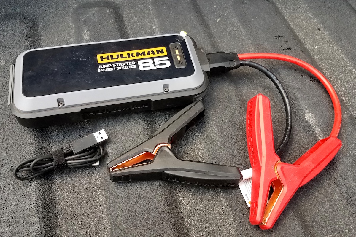
2) Portable battery jump-starter
Have you been there: A dead battery because someone didn’t shut the truck door all the way and with the midnight sun, nobody saw the dome light on. Uh-oh.
Luckily we carried a portable jump starter and we didn’t need to wait and flag another vehicle down to help or try and maneuver a vehicle close enough for the jumper cables to reach.
I was grateful to have this Hulkman portable lithium battery jump-starter the two times we needed it on our trip. Bonus: You can keep it in your vehicle the rest of the year because of its small size.
This small portable jump-starter enables you to jump your own vehicle (multiple times on one charge). Then plug the device into a USB outlet or regular outlet to recharge it (which is does very fast). You can also charge other devices (like phones, cameras, laptops) from the jump starter.
You may never need it but it sure is handy when you do need it or someone else needs it.
3) Gas cans
Remember number one above-gas stations. If you have a very fuel efficient vehicle, you should be fine driving to Alaska. If you’re hauling a travel trailer and you have room for one or two extra gas cans, I’d recommend bringing them. We used them one day on a long stretch between gas stations while we were battling a fierce headwind. We would have been fine without them, but the peace of mind was helpful.
If you’re staying on the main highways during the summer, then there typically are enough gas stations. If you plan to venture on side trips or go north off of the Alaska Highway, then gas cans are recommended.
If you fill them up with cheaper gas at home, they can also defray the cost of the most expensive gas.
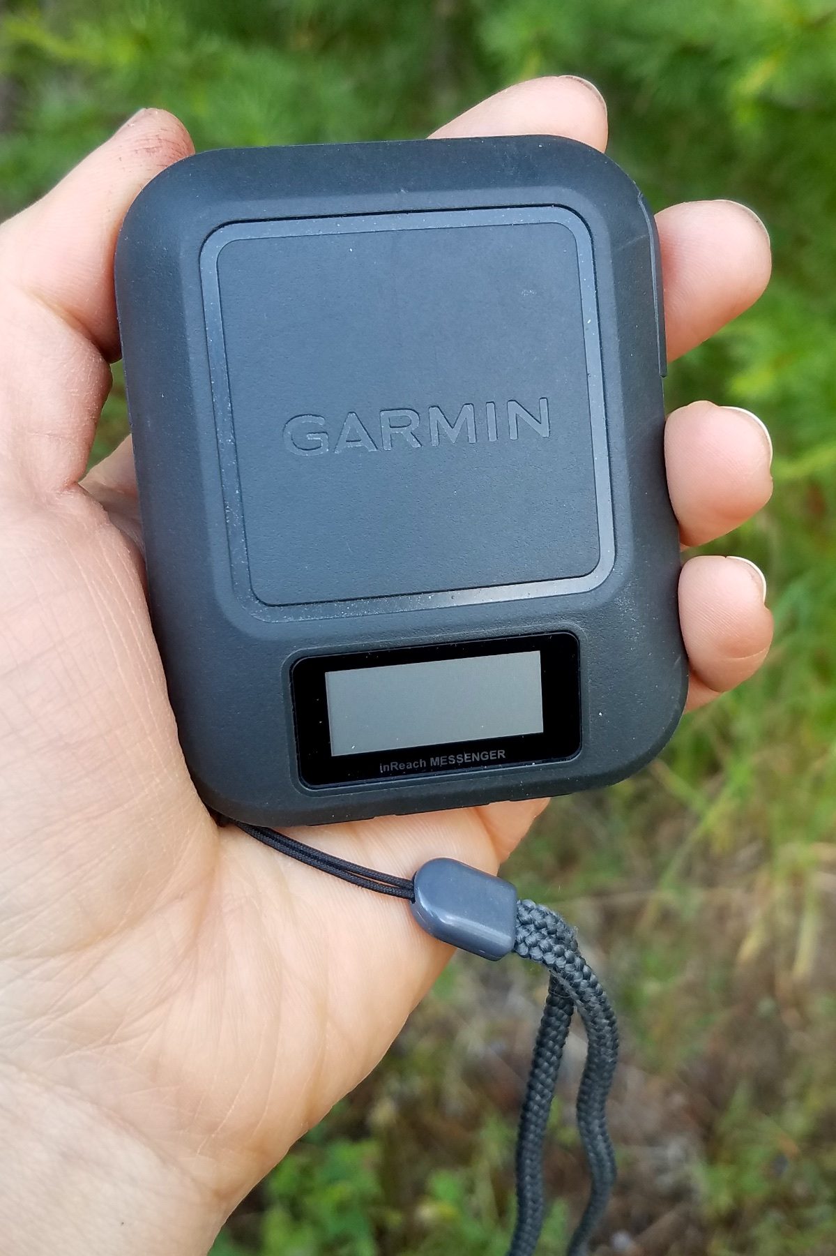
4) Garmin Inreach Messenger
Remoteness. There are a lot of areas without cell service and some areas where you may not see another vehicle for awhile depending on the time of year. If you are in trouble (physical or mechanical), then having a Garmin Inreach Messenger is peace of mind. Garmin staff the emergency response coordination center 24 hours.
We never used our Garmin Inreach Messenger for emergencies on this trip. However, the Garmin Inreach Messenger lets you send preprogrammed messages and allows you to text through their app using the Iridium satellite network. We were able to update family on our whereabouts a few times during the trip plus each message comes with a location tag.
Garmin has a monthly subscription or yearly subscription for the Inreach Messenger. We have the annual subscription for hiking and recreating around home since we don’t have good cell service in our mountains. This enables us to contact family or friends in case we have a flat tire or are running late.
Garmin statistics show that one in every five SOS triggers are for helping a third-party individual. You may not need the help, but someone else may need it.
Final advice on driving to Alaska
If you are planning on driving to Alaska via the Alaska Highway or Cassiar Highway, enjoy your adventure! I hope you have an awesome road trip driving to Alaska!
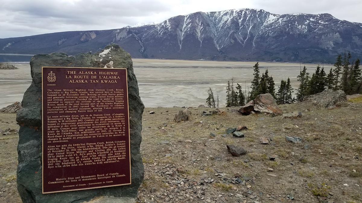
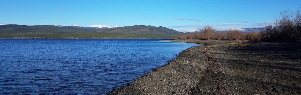
Every road trip on the Alaska Highway and Cassiar Highway is different. Enjoy the views, wildlife, history and culture.
Please leave a comment below if you have additional advice or questions.
Disclaimer: Please note some of the links are affiliate links and as an Amazon Associate, I earn from qualifying purchases through these links. These links help you find products plus support this website. I have purchased and used all of the products and any opinions expressed are entirely my own.


Thanks for the post 👍👍